

Standing at 4200 m above sea level, watching the first golden rays of the morning light up the mighty Kanchenjunga massif is a sight to behold. For a moment, you will be standing in divine silence, broken only by your own breath, forming clouds in the crisp mountain air.
Yes, your moustache may freeze. Yes, your boots will betray you. But that’s part of the charm. Dzongri top rewards the stubborn and punishes the lazy in equal measure.
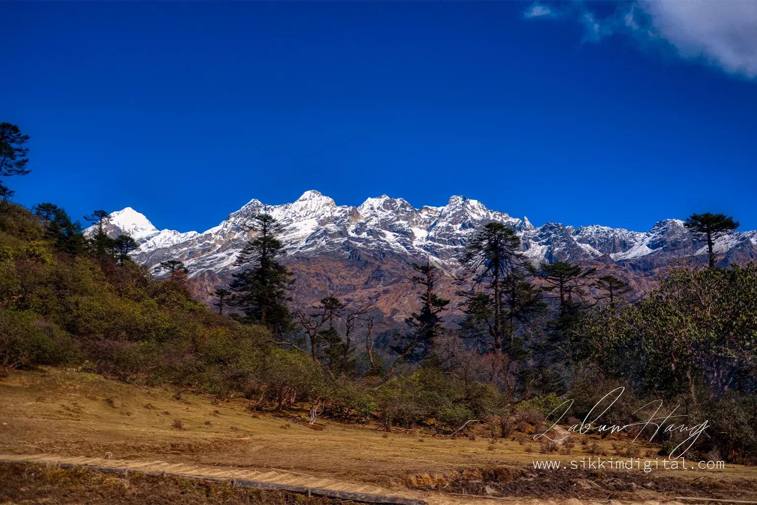
When the peaks like Pandim, Kabru, and Rathong emerge from their dark slumber in a spectacular theatre of light and shadow, you will know why the Dzongri Trek is considered one of the Himalayas’ most rewarding journeys.
The Dzongri Trek, snuggled in the heart of Sikkim’s untouched wilderness, serves as your gateway to the sacred Khangchendzonga National Park-a UNESCO World Heritage site.
Ancient forests will greet you on your way to alpine meadows, and every step forward reveals breathtaking panoramas of the world’s third-highest mountain range. This remarkable journey through Sikkim’s Himalayan Crown brings together raw natural beauty, rich Sikkimese culture, and the profound challenge of high-altitude trekking.
Unlike your Instagram feed, this place is not curated. No cafes on the ridge. No Wi-Fi under the trees. Just relentless climbs, collapsing breath, and Incredible views that might just move you to tears.
This guide focuses on keeping you safe and helping you succeed on the trek, because explaining to your family why you’re stuck on a mountain with frozen facial hair is nobody’s idea of fun.
I have included practical advice, current information, and important safety tips based on years of mountain experience. The difference between a great trek and a dangerous one often comes down to proper preparation and following safety rules.
Whether you are new to high-altitude trekking or experienced, this guide will help you make the most of your Dzongri adventure.
Table of Contents:
- Dzongri Trek at a Glance: Quick Overview & Key Facts
- Detailed Dzongri Trek Itinerary (5-8 Days Options)
- Dzongri Trek Difficulty: Are You Ready?
- Dzongri Trek Solo: Why It Is Not Just Ill-advised—It Is Practically Impossible
- Acute Mountain Sickness (AMS) & High-altitude Emergencies: Your Safety Guide
- Dzongri Trek best time: Seasons & Weather
- Dzongri Trek Cost & Budgeting: Plan Your Expenses
- How to Reach Dzongri Trek (Yuksom): A Travel Guide
- What to Pack for Dzongri Trek: Your Essential Checklist
- Exploring the Dzongri Trail: Key Locations & Experiences
- Safety & Important Trekking Tips for Dzongri
- Why Local Agents Are Non-negotiable for Dzongri Trek
- Group Travel: Your Safety Net in the Himalayas
- Respect the Mountains, or Do Not Come
- Listen to Your Body—Or the Mountain Will Make You
- Final Words Before You start packing
Dzongri Trek at a Glance: Quick Overview & Key Facts
| Start/End Point: | Yuksom (1780 m / 5840 ft) |
| Highest Point: | Dzongri Top (4200 m / 13,780 ft) |
| Total Distance: | Approximately 42 to 50 km (round trip) |
| Duration: | 5-8 days (depending on pace and chosen itinerary) |
| Difficulty: | Moderate to Difficult (requires good physical fitness and proper acclimatization) |
| Permit Required: | Yes (Inner Line Permit for Indian nationals, Protected Area Permit for foreigners) Note: Your permit formalities will be handled by your local travel operator. |
| Best Seasons: | Spring (April-June) and Autumn (October-November) |
| Trek Grade: | High-altitude trek with significant elevation gain |
The Dzongri Trek facts paint a picture of serious mountain adventure. Starting from the historic village of Yuksom, trekkers ascend nearly 2500 m over challenging terrain that transitions from dense subtropical forests to stark alpine landscapes.
Understanding the challenge
The Dzongri Top altitude places this trek firmly in high-altitude territory, where proper acclimatization becomes critical for both safety and enjoyment. The Dzongri trek duration flexibility allows for different fitness levels and time constraints, though rushing this journey compromises both safety and experience.
The moderate to difficult Dzongri trek difficulty rating reflects not just the physical demands, but the technical challenges of high-altitude trekking, unpredictable weather, and remote terrain far from medical facilities. Understanding these facts before departure ensures realistic expectations and proper preparation for one of Sikkim’s most demanding yet rewarding mountain adventures.
Detailed Dzongri Trek Itinerary (5-8 Days Options)
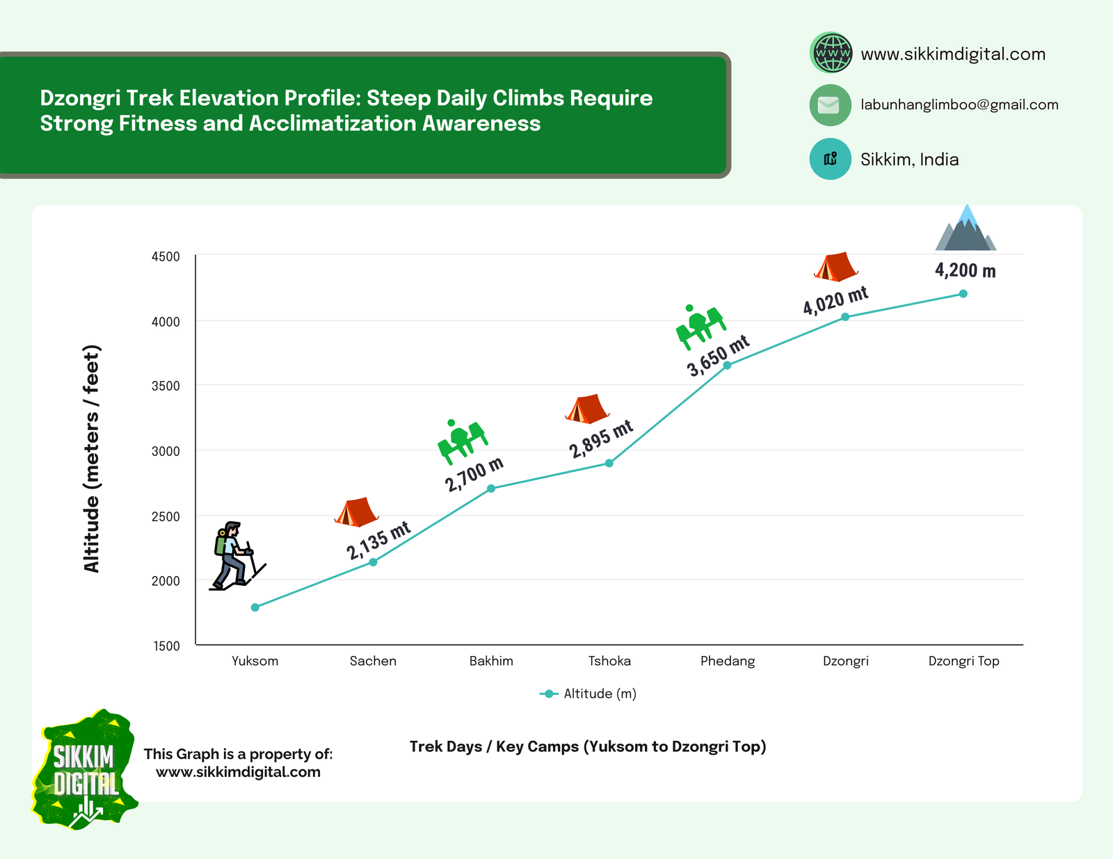
Day 1: Arrival in Yuksom (1780 m)
Your Dzongri trek itinerary officially begins in Yuksom, a historic town that once served as the first capital of Sikkim. Reaching Yuksom involves a long and scenic 6 to 7 hour drive from either Bagdogra Airport or New Jalpaiguri Railway Station.
Due to the duration and fatigue of this journey, it is highly advisable to arrive in Yuksom at least two days before your trek starts. This buffer allows sufficient time to rest, get your body accustomed to the altitude, and handle all pre-trek logistics without stress.
Use this extra day to coordinate with your travel operator for permit processing and to complete a detailed equipment check with your guide. With a full day at your disposal, you can also explore Yuksom’s rich cultural landscape.
A short acclimatization walk to Dubdi Monastery, nestled on a nearby hilltop, offers both a gentle physical warm-up and an introduction to the spiritual heritage of the region. Do not miss the chance to engage with locals at nearby tea houses—their stories, hospitality, and traditional Sikkimese cuisine provide a meaningful prelude to the journey ahead.
Day 2: Yuksom to Sachen (2200 m) – 7 km, 4-5 hours
The Yuksom to Dzongri route begins with a gradual ascent through dense mixed forests alongside the melodious Prek Chu River. This first day’s terrain introduces you to the region’s incredible biodiversity, with towering rhododendrons, magnolias, and ancient oak trees creating a natural cathedral overhead.
The trail crosses the impressive Paha Khola bridge, where the rushing waters below remind you of the monsoon’s power that carved these valleys. Sachen camp, nestled in a forest clearing, offers your first taste of wilderness camping. The 420 m elevation gain feels manageable, but pay attention to your body’s responses as acclimatization begins here.
Day 3: Tshoka to Dzongri via Bakhim (2700 m) – 8 km, 5-6 hours
Today’s trek involves a steady and often strenuous climb through lush, moss-draped rhododendron and magnolia forests—a truly magical experience in spring when the entire trail bursts into a riot of red and pink blooms. After about 3 to 4 kilometers, you will reach Bakhim, a small resting point at around 2700 m. This is an ideal spot for a short break and a warm cup of tea, as it marks a noticeable shift in both terrain and altitude.
From Bakhim, the trail becomes steeper and more winding as it leads you to Tshoka, a picturesque high-altitude campsite perched at 2950 m. Tshoka is not a village in the traditional sense; it is a former settlement-turned-trekker outpost, featuring a few wooden trekkers’ huts, designated camping platforms, and a small hilltop monastery that adds a spiritual calm to the rugged wilderness.
Reaching the high country
From the slopes above Tshoka, you will catch stunning downward views of Yuksom, now far below in the valley, appearing like a cradle nestled among green hills. The climb today also marks your most substantial altitude gain so far, so acclimatization becomes especially important. Pay close attention to your body, stay well-hydrated, and follow your guide’s instructions closely regarding rest and symptoms of altitude-related stress.
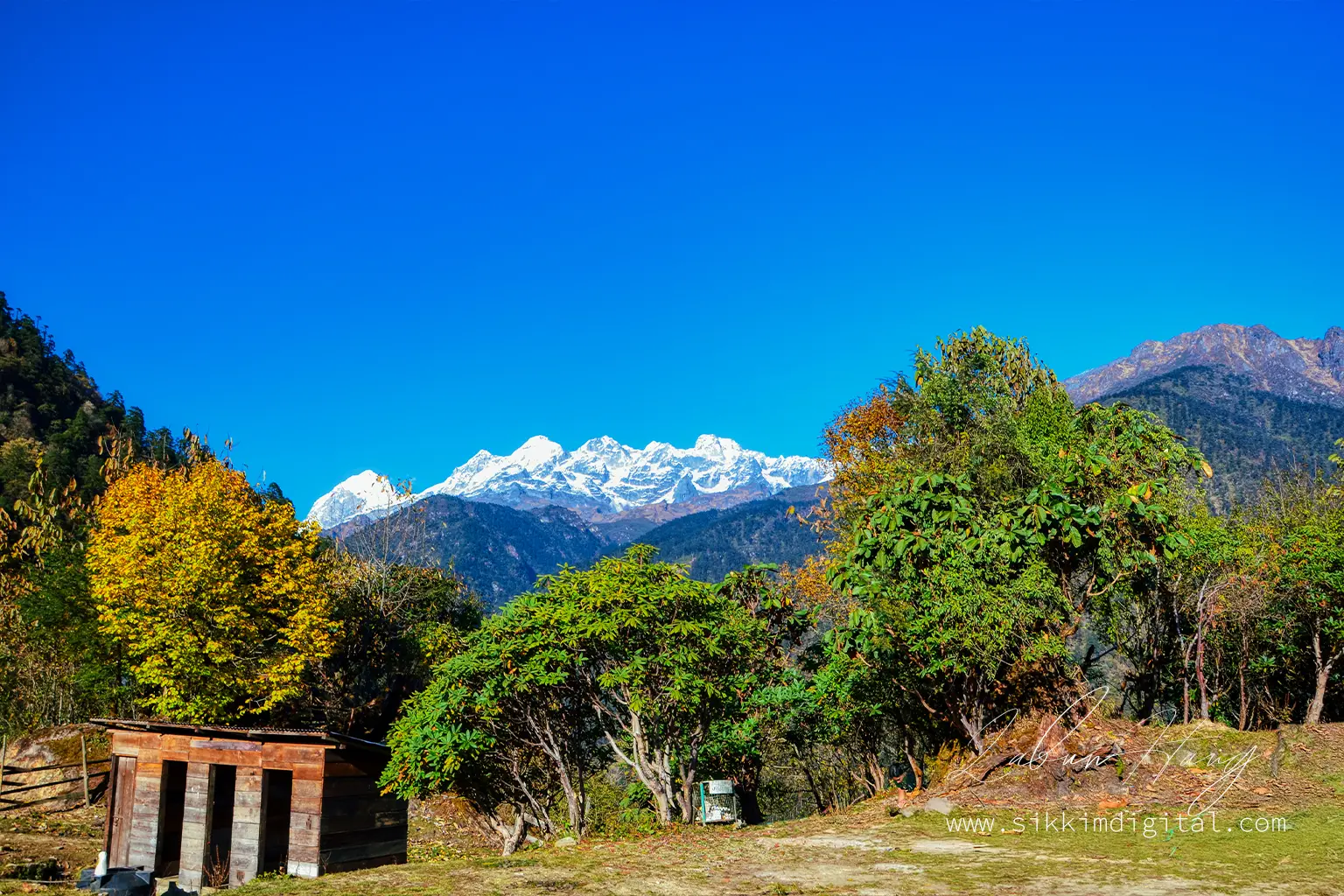
By late afternoon, the skies often clear to reveal majestic glimpses of Mount Pandim, hinting at the high-altitude drama that awaits further up the trail.
Day 4: Tshoka to Dzongri (4020 m) via Phedang (3650 m) – 9 km, 6-7 hours
Today’s journey takes you deeper into the high Himalayas, as the trail climbs sharply from the forested outpost of Tshoka to the windswept meadows of Dzongri, located at 4020 m. This is one of the most challenging and rewarding stretches of the entire trek, as you gain over 1000 m in elevation in a single day.
The path begins with a steep stone-paved trail that ascends through dense rhododendron forests. In spring, the landscape is ablaze with crimson and violet blossoms; in autumn, golden light filters through the thinning canopy.
The transition zone
After about 2 to 3 hours, you will reach Phedang (3650 m), a large clearing where trekkers usually stop for lunch or rest. This crucial waypoint features distinctive wooden walkways that protect fragile alpine vegetation while providing safe passage across boggy terrain. From here, the trail continues its uphill push toward Deorali Top, a ridge that marks a transitional zone where trees begin to thin out and the air turns crisp and dry.
As you approach Dzongri, the environment shifts dramatically—lush forests give way to rugged alpine terrain, dwarf shrubs, and open grasslands. The final push to Dzongri Base Camp requires mental fortitude as much as physical strength. The 1070 m elevation gain over rocky terrain and exposed ridges tests your preparation and determination.
Arriving at base camp
Upon reaching Dzongri campsite, you are now in a high-altitude zone where temperatures can drop quickly, especially after sunset. The terrain is stark yet stunning, with the wide, open meadows providing a perfect setting for stargazing under clear skies. Resist the temptation to immediately rest—instead, walk around the campsite to aid acclimatization before settling in for the night.
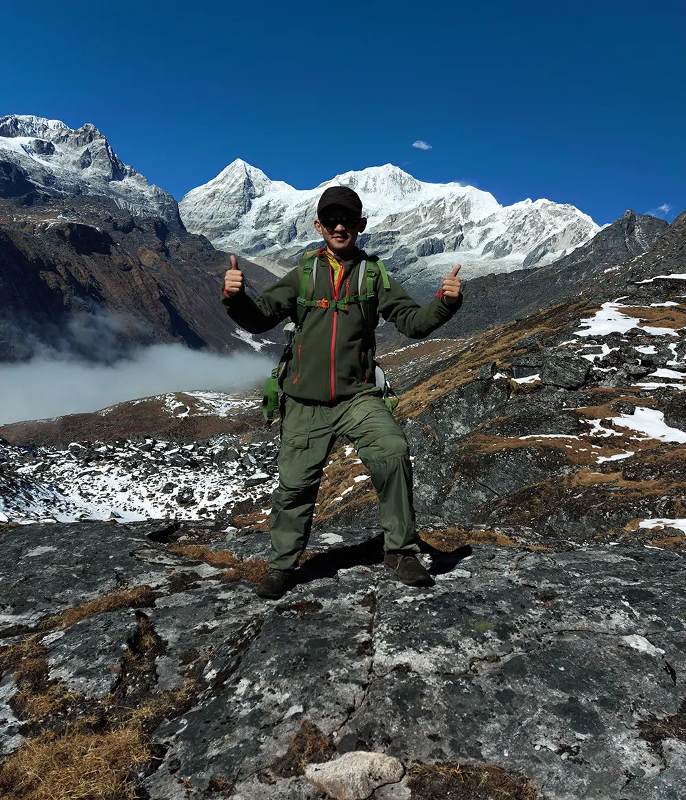
Day 5: Dzongri Top sunrise, day hike around the Dzongri meadows (4200 m)
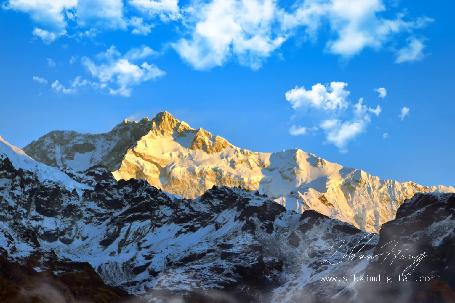
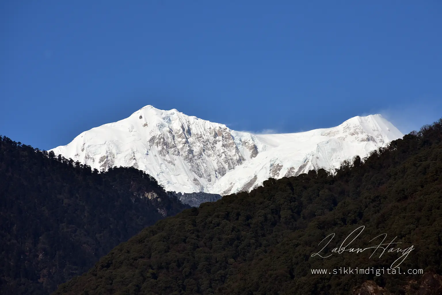
This day is often remembered as the emotional and visual peak of the Dzongri Trek. Before dawn, you will begin a short yet demanding ascent to Dzongri Top (approximately 4200 m), gaining just 180 m in elevation—but at this altitude, even a modest climb feels intense. As the first light touches the horizon, the panoramic view from Dzongri Top emerges like a Himalayan revelation.
To the east, Kanchenjunga looms in all its glory, flanked by the equally awe-inspiring peaks of Pandim, Kabru, Rathong, Simvo, Kokthang, and Goecha Peak. This grand amphitheater of ice and stone offers a moment of stillness and scale that leaves many trekkers silent in reverence.
Optional exploration
After descending back to camp for breakfast, those feeling strong and energetic may opt for a day hike to Dzongri La Pass, a lesser-known but highly rewarding destination offering deeper views into the Singalila Ridge and towards the Nepal border. Though not overly technical, this optional extension should only be attempted if weather conditions are favorable and your body feels adequately adjusted.
Day 6: Dzongri to Tshoka – 7 km, 4-5 hours
The descent begins with mixed emotions—sadness at leaving the high country balanced by relief as oxygen-rich air fills your lungs more easily. The steep downhill terrain demands careful attention to foot placement; many trekking injuries occur during descents when fatigue combines with loose rock and complacency. Returning to Tshoka’s forested environment feels like entering a different world after the stark alpine landscape above. Your knees and calves will feel the descent’s impact, making trekking poles invaluable companions.
Day 7: Tshoka to Yuksom – 15 km, 6-7 hours
The final descent through familiar rhododendron forests and river crossings closes your mountain adventure circle. Though physically demanding due to distance, the psychological relief of completing the high-altitude portion often energizes trekkers for this longest day. Arriving back in Yuksom brings mixed emotions—pride in your accomplishment tempered by the inevitable sadness that comes with ending such a profound mountain experience.
Day 8: Departure from Yuksom
Transportation arrangements back to Bagdogra or New Jalpaiguri typically begin early, allowing time to reach afternoon flights or evening trains. Many trekkers find this transition day essential for processing the intensity of their Himalayan experience before returning to normal life.
Dzongri Trek Difficulty: Are You Ready?
The Dzongri trek difficulty rating of “Moderate to Difficult” reflects multiple challenging factors that combine to create a serious high-altitude mountaineering experience. Understanding these challenges honestly determines whether you’re ready for this demanding adventure.
Physical demands
Steep ascents and rapid altitude gain form the trek’s primary physical challenge. Gaining nearly 2500 m elevation over just four days pushes even fit trekkers to their limits. Unlike gradual mountain walks, the Dzongri route demands sustained uphill effort through increasingly thin air, where each step requires greater effort than at sea level.
Altitude exposure
High altitude exposure and AMS risk cannot be understated. Above 3000 m, every trekker faces potential altitude sickness regardless of fitness level. The Dzongri Goechala trek difficulty increases significantly as oxygen levels drop to roughly 60% of sea level concentrations at the highest points. Your body’s ability to adapt varies unpredictably, making physical preparation only part of the equation.
Environmental challenges
Cold temperatures and unpredictable weather add environmental stress to physical demands. Spring temperatures range from pleasant daytime warmth to sub-zero nights, while autumn brings crystal-clear views alongside bitter cold. Weather changes happen rapidly at altitude; sunshine can transform to snow squalls within hours, creating hypothermia risks for unprepared trekkers.
Remote terrain considerations
Remote terrain and infrastructure limitations mean self-reliance becomes critical. Beyond Yuksom, no roads, hospitals, or rescue services exist except what your trekking team provides. This isolation makes every decision—from pacing to equipment choices—potentially significant for your safety and success.
Preparation requirements
Physical preparation for Dzongri trek requires months of consistent training focusing on cardiovascular endurance and leg strength. Regular hiking with a loaded backpack, running, cycling, and stair climbing build the foundation needed for sustained uphill effort. However, fitness alone doesn’t guarantee success; mental preparation for discomfort, cold, and fatigue proves equally important.
Is this suitable for beginners?
Is Dzongri trek suitable for beginners? The honest answer is no, not for complete beginners to high-altitude trekking. While first-time Himalayan trekkers can successfully complete Dzongri with proper preparation, some previous multi-day trekking experience at moderate altitudes provides valuable foundation skills and self-knowledge about your body’s responses to mountain stress.
Dzongri Trek Solo: Why It Is Not Just Ill-advised—It Is Practically Impossible
Unlike commercial trekking routes that pass through inhabited villages with guesthouses and food stops, the Dzongri Trail cuts through remote mountain wilderness inside a protected national park. There are no restaurants, no tea houses, and no self-service infrastructure.
Every step past Yuksom relies entirely on logistical support—guides, porters, cooks, pack animals, tents, fuel, food, and permits, all of which are coordinated by licensed trekking agencies.
The operational reality
Attempting to trek solo here is not just risky—it is operationally unfeasible. Without a pre-arranged support team, you would have no access to shelter, meals, or emergency resources once you leave Yuksom. This is a high-altitude trail with unpredictable weather, no mobile network coverage, and evacuation services is not easy.
Even experienced mountaineers do not undertake this trail alone, because a medical emergency or injury in these conditions could prove fatal without backup.
Legal requirements
Group trekking is legally and logistically necessary. The trail regulations often require you to be accompanied by a registered guide, and park entry permits are typically processed through government-authorized agencies.
Before signing up, evaluate your readiness—not just in terms of fitness, but also your experience with remote wilderness trekking, your tolerance for high-altitude conditions, and your ability to function under stress in unpredictable terrain. Dzongri is not a casual outing; it is a demanding expedition that rewards humility, preparation, and teamwork.
Acute Mountain Sickness (AMS) & High-altitude Emergencies: Your Safety Guide
Understanding and preventing Acute Mountain Sickness forms the cornerstone of safe high-altitude trekking on Dzongri. This comprehensive guide could save your life or that of a fellow trekker when symptoms of acute mountain sickness on Dzongri trek appear.
What is AMS?
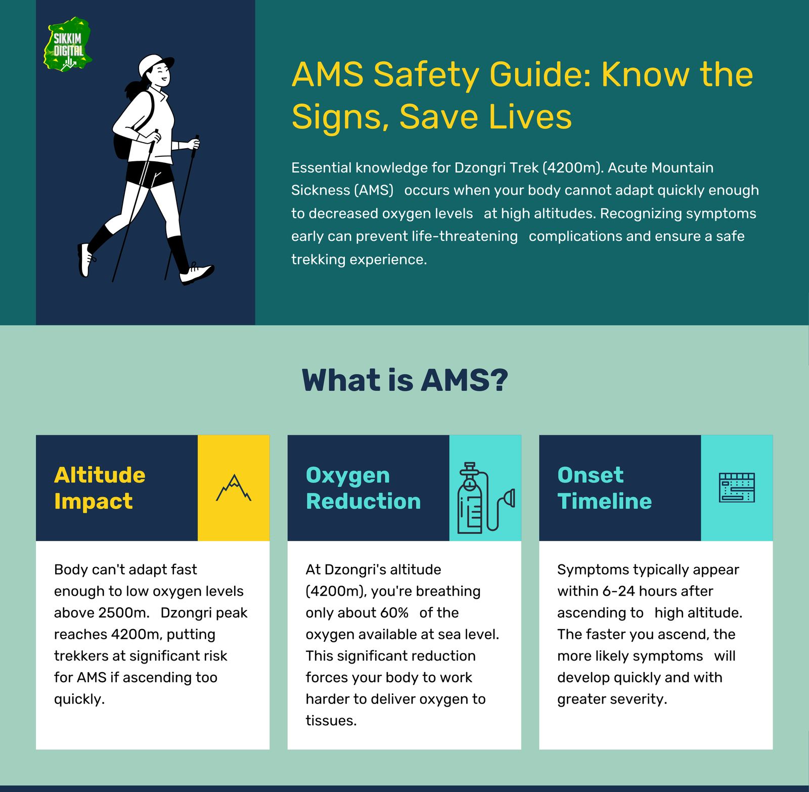
Acute Mountain Sickness arises when your body cannot adjust quickly enough to decreased atmospheric pressure and reduced oxygen availability above 2500 m. Common symptoms include persistent headache, nausea, dizziness, fatigue, loss of appetite, and disturbed sleep patterns. These symptoms typically appear 6-24 hours after reaching higher altitude.
Causes stem from the fundamental physics of altitude. At Dzongri’s maximum elevation of 4200 m, atmospheric pressure drops to approximately 60% of sea level, meaning each breath delivers significantly less oxygen to your bloodstream. Your body requires time to produce additional red blood cells and adjust breathing patterns to compensate for this oxygen deficit.
Symptom recognition

Differentiating AMS from other symptoms requires careful observation and honest self-assessment. Unlike dehydration (which improves with fluid intake) or food poisoning (which involves digestive symptoms), AMS headaches worsen with physical activity and don’t respond to normal headache remedies. A pulse oximeter provides objective data—blood oxygen saturation below 85% at altitude indicates concerning oxygen deprivation requiring immediate attention.
Severe complications
Potential Complications (Severe Altitude Sickness) can become life-threatening within hours:

HAPE (High Altitude Pulmonary Edema) occurs when fluid accumulates in the lungs. Warning signs include:
- Persistent dry cough progressing to pink, frothy sputum
- Severe breathlessness even at rest
- Chest tightness
- Gurgling sounds when breathing
HAPE can kill within hours without immediate descent.
HACE (High Altitude Cerebral Edema) results from brain swelling due to fluid accumulation. Symptoms include:
- Severe headache unresponsive to medication
- Confusion
- Loss of coordination (inability to walk a straight line)
- Slurred speech
- Irrational behavior
- Seizures
- Loss of consciousness
HACE represents a medical emergency requiring immediate evacuation.
Emergency treatment
Treatment (Immediate Action): DESCEND IMMEDIATELY.

I am not being dramatic, but this is literally a moment of life or death. When someone has severe altitude sickness, going down is the only thing that actually fixes it. Every minute you waste debating or “seeing if they feel better” increases the chance of permanent brain damage or worse.
The “Triple One Test” provides early detection: if someone cannot touch their nose with eyes closed, walk a straight line heel-to-toe, or demonstrates personality changes, assume severe AMS and begin immediate descent.
Medication protocols
Diamox (Acetazolamide) serves as the primary medication for AMS treatment and prevention. The typical curative dose is 250mg twice daily, but this should only be used under medical supervision and never replaces the need for descent if symptoms worsen.
For HAPE treatment: Nifedipine (20mg extended-release every 12 hours) combined with Diamox can provide temporary relief during evacuation, but these medications buy time for descent—they do not cure the condition.
HACE treatment: Dexamethasone (8mg initial dose, then 4mg every 6 hours) plus Diamox, again only as evacuation aids while descending as rapidly as safely possible.
A Gamow bag (portable hyperbaric chamber) can provide temporary relief equivalent to descending 1500-3000 m, but serves only as a bridge to actual descent, not a cure.
Critical communication
Absolutely inform your guide and trekking companions immediately when experiencing any AMS symptoms. Pride and denial kill people in the mountains—early intervention saves lives.
Prevention strategies
Preventive strategies form your first and best defense:
Hydration: Drink 50% more water than normal, including warm fluids, herbal teas, and soups. Dehydration significantly increases AMS risk.
Pacing: Don’t run. You are not here to win a trophy or gold medal in a marathon. You are here to blend with nature. But that does not mean walking like a tortoise, either. Find your comfortable walking pace. Whenever you stop, take a long breath through your nose and exhale through your mouth. The best advice I can give you is to practice mindfulness. When you walk, count your steps or count your breath. Don’t make the mistake of inhaling through your mouth as you go higher.
Acclimatization activities: Avoid sleeping immediately upon reaching each day’s camp. Walk around for 30-60 minutes to aid circulation and acclimatization before resting.
“Walk high, sleep low” means climbing to a higher point during the day before returning to sleep at a lower elevation. On Dzongri, this principle applies particularly on acclimatization days when climbing Dzongri Top and hike to Dzongrilla Pass before returning to base camp for the night.
Gradual ascent: The “Climb Slow” guideline advises limiting altitude gain to no more than 300 m per day once above 3000 m, and recommends a full rest day after every 1000 m of ascent. The Dzongri trek itinerary reflects these principles through its gradual elevation profile and well-timed halts.
Preventive medication
Preventive medication with Acetazolamide (Diamox) can reduce AMS risk when started 1-2 days before ascent. Typical preventive dosing is 125mg twice daily, but consult a physician before use as individual responses vary significantly. Common Diamox side effects include tingling in fingers and toes, frequent urination, and metallic taste affecting water and carbonated beverages. These effects are normal and not dangerous.
Emergency evacuation
There are rare moments on this trek when decisions must be made fast and without debate. When HAPE (High Altitude Pulmonary Edema) or HACE (High Altitude Cerebral Edema) symptoms appear or escalate, the person will start acting confused or loopy. You will see signs of fluid building up in their lungs or brain. At that point, the priority is not reaching the next campsite—it is getting down. Immediately.
Getting evacuated from Dzongri is no joke. We’re talking about a stretcher carried by a team of porters over rough terrain for 12-24 hours straight. It’s brutal work, and frankly, it’s not cheap either. But when someone’s life is on the line, that’s what it takes to get them to a road where real help can reach them.
Recovery requirements
Here’s something crucial: don’t think you can just drop down to the next camp and call it good. To actually recover from serious altitude sickness, you need to get way down—below 2743 m. That usually means going all the way back to Yuksom.
I know it sounds extreme, but those halfway measures? They might make you feel better temporarily, but the symptoms often come roaring back.
This is why prevention is very important. Proper acclimatization, early recognition of symptoms, and honest communication with your guide form the real safety net. Take your time going up, listen to what your body tells you, and don’t brush off the early warning signs.
The mountain can always wait. Your health and life cannot.
Dzongri Trek best time: Seasons & Weather
Timing your Dzongri Trek determines not only your comfort and safety, but the quality of views and overall experience you’ll enjoy in these spectacular mountains.
Spring (April-June)
Spring (April-June) represents one of two ideal windows for the best time for Dzongri trek. April brings the famous rhododendron blooms that transform the forests into tunnels of red, pink, and white blossoms—a photographer’s paradise and naturalist’s dream.
May offers the most stable weather patterns with clear morning skies perfect for mountain photography, while June provides the warmest temperatures but increased afternoon cloud buildup.
Spring Dzongri trek weather features daytime temperatures ranging from 10-15°C at Tshoka to -5°C at Dzongri Base Camp, with nighttime temperatures dropping 10-15 degrees lower. Morning visibility typically remains excellent, with clouds building after noon—making early starts essential for clear mountain views.
Autumn (October-November)
Autumn (October-November) provides the second premium season, often considered superior for Kanchenjunga views due to post-monsoon atmospheric clarity. October delivers crisp, stable weather with minimal precipitation and crystal-clear mountain visibility.
November brings colder temperatures but often the most spectacular sunrise views as ultra-dry air creates exceptional transparency.
Autumn temperatures range from 5-10°C during the day at higher elevations, dropping to -10°C or lower at night. The dry, stable conditions make this period ideal for photography, though warmer sleeping gear becomes essential.
Winter considerations
Dzongri Winter Trek (December-February) appeals only to highly experienced winter mountaineers seeking extreme challenges. Snow covers the trail above Tshoka, temperatures plummet to -20°C or below, and weather conditions become unpredictable and potentially dangerous.
Winter trekking requires specialized equipment, extensive cold-weather experience, and acceptance of significantly higher risks.
Monsoon season: avoid
The Sikkim trekking season explicitly excludes monsoon months due to multiple serious hazards. Heavy rainfall creates treacherously slippery trails, increases landslide risks dramatically, and makes stream crossings dangerous or impossible.
Leeches become a constant nuisance, while persistent cloud cover eliminates mountain views—the trek’s primary reward. Monsoon Dzongri trek attempts face high cancellation rates, evacuation difficulties during emergencies, and fundamentally unsafe conditions that no responsible guide service should accept.
Temperature ranges by season/altitude
Yuksom (1780 m): Spring 15-25°C day/5-10°C night; Autumn 10-20°C day/0-5°C night
Tshoka (2950 m): Spring 10-15°C day/-5-0°C night; Autumn 5-10°C day/-10–5°C night
Dzongri (4020 m): Spring 5-10°C day/-10–5°C night; Autumn 0-5°C day/-15–10°C night
These ranges represent typical conditions—mountain weather remains inherently unpredictable, making flexible itineraries and proper equipment essential regardless of season choice.
Quick Table
Dzongri Trek Cost & Budgeting: Plan Your Expenses
Understanding the Dzongri trek cost per person enables realistic budgeting for this significant mountain adventure. Current estimates range from ?14,000-22,000 per person for a standard 5-6 day trek, though costs vary significantly based on group size, service level, and seasonal demand.
Cost breakdown (per person basis)
Forest entry & trekking fees: ?1,200-1,500 for Indian nationals, with Protected Area Permits for foreigners adding ?2,000-3,000. These Dzongri trek permit costs change annually, so verify current rates with local authorities.
Mandatory guide services: ?1,500-2,000 per day for certified local guides—legally required and practically essential for safety, navigation, and emergency response. The Dzongri trek guide cost reflects their expertise in high-altitude rescue, local weather patterns, and route-finding skills that prove invaluable in challenging conditions.
Cook & porter services: ?1,000-1,500 per day for professional cooks who manage nutrition at altitude, plus ?800-1,200 per day per porter for carrying group equipment and supplies.
Pack animals (yaks/dzos): ?800-1,200 per animal per day for carrying heavy equipment above Tshoka, where steep terrain makes human porterage impractical or unsafe.
Equipment rental: ?500-800 per day for complete camping setups including high-altitude tents, sleeping mattresses, and cooking equipment suitable for extreme mountain conditions.
Food & fuel: ?800-1,200 per person per day for nutritious, high-energy meals designed for altitude and cold weather conditions, plus cooking fuel for the entire journey.
Group economics
Group vs. Solo Trek Economics strongly favor group participation beyond safety considerations. Fixed costs like guide fees, permits, and equipment divide among group members, reducing individual Dzongri trek budget requirements by 30-50% compared to solo arrangements—which responsible operators won’t provide due to safety concerns.
Groups of 4-6 trekkers achieve optimal cost efficiency while maintaining manageable logistics and group dynamics. Larger groups may reduce per-person costs slightly but can complicate movement and campsite management.
Additional expenses
Beyond the base trek package, several extra expenses require separate budgeting. Transport to and from Yuksom can cost between ?5,000 to ?7,000 if you are coming from Bagdogra or New Jalpaiguri. You should also factor in the cost of staying in base towns before and after the trek, which typically ranges from ?1,500 to ?3,000 per night.
Other potential expenses include personal gear purchases, emergency evacuation insurance (strongly recommended), and tips for your trekking team—guides, porters, and cooks—usually amounting to 10 to 15 percent of the total trek cost.
Permit considerations
For foreign trekkers, the Dzongri trail falls under restricted zones, requiring both a Protected Area Permit (PAP) and an Inner Line Permit (ILP). These cost between ?4,000 to ?6,000, depending on nationality and current regulations. These permits must be arranged in advance through licensed tour operators, as applying individually can be time-consuming and difficult.
Budget buffer
Lastly, set aside an extra 20 to 30 percent of your overall budget to cover unexpected weather delays, last-minute gear needs, or other surprises that often come with mountain travel. A cautious budget allows you to enjoy your trek without unnecessary stress.
How to Reach Dzongri Trek (Yuksom): A Travel Guide
Reaching Yuksom, the gateway for your Dzongri Trek adventure, requires careful planning and realistic time allocation for this remote Himalayan destination.
By air: Bagdogra Airport (IXB)
Bagdogra Airport (IXB) serves as the primary aviation gateway, located approximately 150 kilometers from Yuksom. Daily flights connect Bagdogra with major Indian cities including Delhi, Mumbai, Chennai, and Kolkata. Upon arrival, pre-arranged private vehicles or shared taxis provide onward transport to Yuksom.
The Bagdogra to Yuksom journey takes 5-7 hours depending on road conditions and weather. The route passes through Siliguri, Geyl Khola, Jorethang, and Naya Bazar before climbing into the mountains via increasingly winding roads. Mountain roads can become challenging during monsoons or winter, potentially extending travel time significantly.
By rail: New Jalpaiguri Junction (NJP)
New Jalpaiguri Junction (NJP) offers extensive rail connectivity across India with regular services from Delhi, Mumbai, Chennai, and Kolkata. NJP to Yuksom requires similar road transport arrangements covering approximately 140 kilometers in 5-6 hours. The railway option often proves more economical than flying, particularly for groups, though overnight journeys from distant cities require additional planning. Pre-booking onward transport from NJP becomes crucial during peak trekking seasons when vehicle availability tightens.
By road: direct road access
Direct road access to Yuksom is possible from Gangtok (120 km, 4-5 hours) and Siliguri (140 km, 5-6 hours) via well-maintained but winding mountain highways. Regular bus services connect these cities, though private vehicles offer greater schedule flexibility and comfort after long-distance travel. The final approach to Yuksom involves steep, narrow mountain roads that can challenge nervous passengers but reward travelers with spectacular valley and mountain views. Road conditions vary seasonally—monsoon damage sometimes requires longer alternate routes.
Local transport considerations
In West Sikkim, shared jeeps offer basic connectivity between major towns, but direct services to Yuksom are very limited. Most shared jeeps to Yuksom seats are often pre-booked by locals, leaving little availability for last-minute travellers.
If you are planning to rely on shared transport, it is strongly recommended to schedule at least two extra days for travel between NJP, Bagdogra, and Yuksom. Delays, vehicle shortages, and multiple transfers are common, especially during the trekking season.
Because of these challenges, most trekkers opt for private vehicles, which eliminate the hassle of multiple stops and help ensure timely arrival.
Arrival timing
Reaching Yuksom by early afternoon is crucial for completing permit formalities, conducting equipment checks, and attending the pre-trek briefing. Late arrivals may require an additional night’s stay.
Booking return transport in advance is also advised, particularly during peak season when vehicles are in high demand. A solid travel plan ensures smoother transitions and lets you focus entirely on your trek experience.
What to Pack for Dzongri Trek: Your Essential Checklist
Proper equipment selection determines your comfort, safety, and success on the challenging Dzongri Trek. This comprehensive Dzongri trek packing list addresses the specific demands of high-altitude Himalayan trekking.
Clothing (layering system)
Clothing (Layering System) forms the foundation of mountain comfort and safety. The layering principle allows temperature regulation as conditions change throughout each day and at different elevations.
Base layers: Moisture-wicking synthetic or merino wool thermal tops and bottoms prevent hypothermia by moving sweat away from your skin. Pack 2-3 sets for the what to pack for Dzongri trek in spring when temperatures fluctuate dramatically. Avoid cotton completely—it retains moisture and loses insulating properties when wet.
Insulating layers: Down or synthetic insulation jackets provide crucial warmth at altitude. A medium-weight fleece jacket offers versatility for active wear, while a puffy down jacket becomes essential for cold mornings and camp time above 3000 m.
Outer shell layers: Waterproof, windproof jacket and pants protect against sudden weather changes common in mountain environments. Look for breathable materials with full-zip ventilation options for temperature control during uphill sections.
Footwear
Footwear demands careful selection as your feet carry you through varied and challenging terrain. Waterproof, ankle-supporting trekking boots with aggressive tread patterns provide essential grip on loose rock, mud, and potentially icy surfaces. Break in new boots thoroughly before departure to prevent blisters during multi-day trekking.
Socks: Merino wool or synthetic blend trekking socks prevent blisters while providing cushioning and moisture management. Pack 4-5 pairs, avoiding cotton socks which cause blisters and lose warmth when wet.
Trekking gear
Trekking Gear supports your journey through demanding mountain terrain:
Backpack: 45-60 liter capacity with rain cover protects your gear while distributing weight efficiently. Ensure proper fit with padded hip belt and adjustable torso length.
Sleeping bag: Temperature rating to -10°C minimum for spring/autumn treks, -20°C for winter attempts. Down insulation offers superior warmth-to-weight ratio, while synthetic insulation performs better in wet conditions.
Trekking poles: Reduce knee stress on steep descents while providing stability on loose terrain. Adjustable, lightweight carbon or aluminum poles prove invaluable for high-altitude trekking.
Health & hygiene
Health & Hygiene items address both routine needs and emergency situations:
First aid kit for high altitude trekking should include:
- Diamox (Acetazolamide) for altitude sickness prevention/treatment (consult physician first)
- Ibuprofen for headaches and inflammation
- Paracetamol for fever and pain
- Loperamide for diarrhea
- Oral rehydration salts
- Antiseptic cream and bandages
- Elastic bandage for sprains
- Thermometer
- Personal prescription medications
Sun protection: High SPF (30+) sunscreen and lip balm with SPF protect against intense UV radiation at altitude. Moisturizer combats dry mountain air effects on skin.
Hygiene items: Hand sanitizer, wet wipes, and personal toiletries maintain health in challenging conditions. Quick-dry towel saves weight and space.
Food & hydration
Food & Hydration supplements organized meal provisions:
Water system: 2-3 liter capacity through bottles or hydration bladders. Water purification tablets or portable filters ensure safe drinking water from mountain streams.
Energy foods: High-calorie, easily digestible snacks including energy bars, nuts, dried fruits, and chocolate provide quick energy during demanding days.
Other essentials
Other Essentials complete your mountain safety and comfort kit:
Lighting: Headlamp with extra batteries enables pre-dawn starts and evening activities. Pack backup flashlight for redundancy.
Eye protection: High-quality sunglasses with UV protection prevent snow blindness and eye damage from intense mountain light.
Navigation & communication: Although guides handle route-finding, personal GPS device or smartphone with offline maps provides backup navigation. Emergency whistle enables signaling if separated from group.
Money & documents: Sufficient cash for tips and emergencies (no ATMs beyond Yuksom), waterproof document pouch containing permits, identification, and emergency contact information.
Personal items: Multi-tool or Swiss Army knife, extra passport photos for permit processing, personal medications, and any comfort items that aid sleep or morale at altitude.
This essential gear for Dzongri trek list prioritizes safety and functionality over luxury. Every item serves multiple purposes or addresses specific high-altitude challenges you’ll encounter during this remarkable mountain adventure.
Exploring the Dzongri Trail: Key Locations & Experiences
The Dzongri Trek reveals itself through a series of remarkable locations, each offering unique natural beauty, cultural significance, and unforgettable experiences that combine to create one of the Himalayas’ most rewarding journeys.
Yuksom: Gateway to the sacred mountains
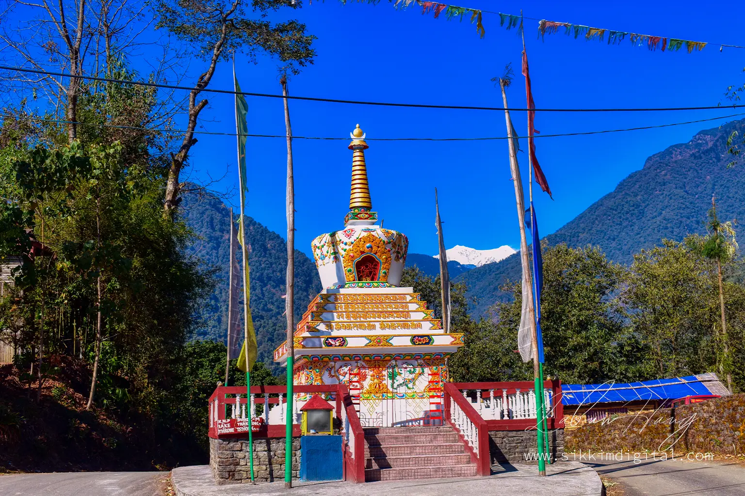
Yuksom, meaning “meeting place of the three lamas,” is more than just the starting point of the Dzongri and Goechala treks—it is a town steeped in deep spiritual and historical significance. Established in 1642 as the first capital of Sikkim, Yuksom was the coronation site of the kingdom’s first Chogyal (monarch), and it still echoes the legacy of that sacred past.
Now home to approximately 1,200 to 1,500 residents, Yuksom has evolved into a compact yet vital trekking hub, offering essential services like guesthouses, equipment rentals, trekking agencies, and government offices for processing permits. Despite this modern role, Yuksom retains its traditional charm, with heritage homes, family-run lodges, and forested footpaths that lead to sites of cultural importance.
Cultural heritage
A short hike leads to Dubdi Monastery, Sikkim’s oldest monastery, perched quietly above the town in the embrace of dense, mossy forests. For those arriving a day or two before their trek, it offers not only cultural depth but also a chance for gentle acclimatization.
Yuksom’s Norbugang Chorten, the coronation throne of the first Chogyal, remains a centerpiece of Sikkimese heritage. The surrounding sacred landscape—including the Kathok Lake and the Kathok Monastery—reveals layers of ritual, legend, and mountain spirituality.
What makes Yuksom unique is how it balances living tradition with mountain hospitality. Local families welcome trekkers not as tourists, but as guests, offering a rare window into life in the Eastern Himalayas—rooted in rhythm, ritual, and resilience.
Khangchendzonga National Park: UNESCO wilderness
Your entire trek takes place inside Khangchendzonga National Park. This UNESCO World Heritage site covers over 1,700 square kilometers of protected Himalayan wilderness. From dense forests to high-altitude glaciers, the park is home to rare wildlife like the Red Panda, Himalayan Black Bear, and even the elusive Snow Leopard.
But this place is more than just nature. Locals consider the mountains sacred. Many peaks are off-limits out of deep spiritual respect. So when you trek here, you are not just walking through a park—you are stepping into a landscape where nature, culture, and faith come together.
Forest environments: Sachen & Bakhim
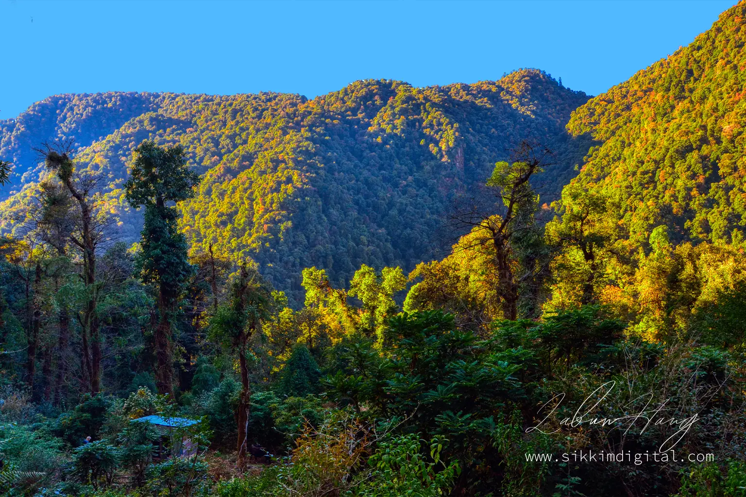
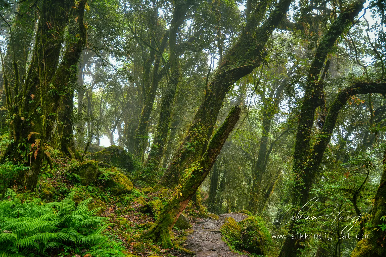
Sachen & Bakhim introduce you to the trek’s magnificent forest environments through well-maintained trails that reveal the Himalayas’ incredible botanical diversity.
Ancient rhododendron trees—some centuries old—create natural tunnels during spring blooms, while towering magnolias and oak trees form cathedral-like spaces that inspire reverence for these mountain ecosystems.
Stream crossings and wooden bridges punctuate the forest journey, with the constant music of flowing water providing soundtrack to your ascent. Wildlife sightings remain possible though not guaranteed—colorful Himalayan birds, curious langur monkeys, and countless butterfly species animate these forest corridors.
Mountain transition: Tshoka campsite
Tshoka, located at around 2950 m, is a scenic rest stop on the way to Dzongri. Surrounded by dense rhododendron and conifer forests, it offers a dramatic change in landscape and atmosphere. This is where the forest opens up just enough to reveal glimpses of distant peaks and shifting cloudscapes.
It is a favorite spot for birdwatchers. Keep your eyes out for the Himalayan Monal, Blood Pheasant, and various thrushes and finches—early mornings are especially rewarding. If you are trekking in spring, the rhododendron bloom turns the entire area into a riot of color.
There is also a small monastery perched on a ridge nearby, worth a short walk for both the view and the silence it offers. The wooden huts here serve as basic accommodation, and most trekkers spend the night before pushing onward to higher camps. With its crisp air, quiet trails, and natural beauty, Tshoka gives you your first real sense of the high Himalayas.
Alpine transition: Phedang
Phedang serves as a crucial rest stop during the challenging ascent to Dzongri, notable for its distinctive wooden walkways that protect fragile alpine vegetation while providing safe passage across boggy terrain.
At 3650 m, this location marks your entry into true high-altitude environments where every step requires more effort and the landscape transforms dramatically from forest to alpine meadows.
The climax: Dzongri viewpoint
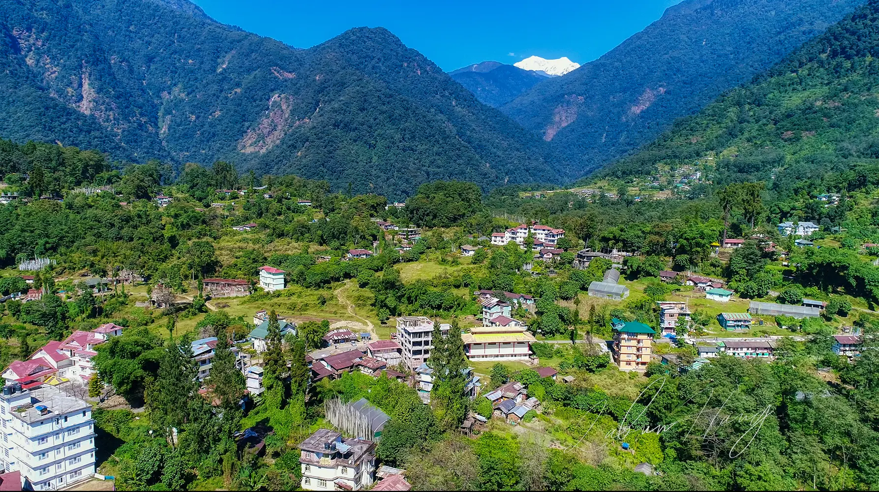
Dzongri Viewpoint represents the emotional and visual climax of your mountain journey. The pre-dawn climb to this 4200 m summit tests your determination one final time before rewarding you with arguably the most spectacular sunrise panorama in the entire Himalayan range.
The Kanchenjunga views from Dzongri Top defy adequate description—the world’s third-highest mountain dominates the eastern horizon like a massive ice cathedral, its 8,586 m summit catching the first golden light while lesser peaks remain shrouded in purple shadow.
Pandim’s elegant pyramid, Jopuno’s sharp ridges, Kabru’s massive bulk, Rathong’s icy flanks, Simvo’s distant presence, Kokthang’s rocky spires, and Goecha Peak’s imposing wall create a 360-degree amphitheater of ice and stone that humbles every observer.
Photographers arrive hours before sunrise to capture this magical transformation as darkness gradually retreats and the great peaks emerge from their nighttime slumber. The silence is profound—broken only by wind and your own breathing—as you witness one of nature’s most spectacular daily performances.
Extended adventure: Goechala trek
Goechala, at 4940 m, is the high point of the extended Dzongri Trek. For those pushing beyond Dzongri, this pass takes you as close as it gets to the towering south face of Kanchenjunga without mountaineering.
The route demands extra days, tougher climbs, and proper acclimatization. But the reward is unmatched—sunrise views over Kanchenjunga, flanked by peaks like Pandim, Rathong, Kabru North and South, all lit in sharp morning gold. It is a full-scale high-altitude experience for those ready to commit.
Mountain companion: Prek Chu River
Prek Chu River provides constant companionship during the trek’s early stages, its crystal-clear waters reflecting forest canopies while creating the soundtrack of rushing water that becomes synonymous with Himalayan trekking. Multiple bridge crossings offer photography opportunities and moments of contemplation beside this lifeline that drains the great peaks above.
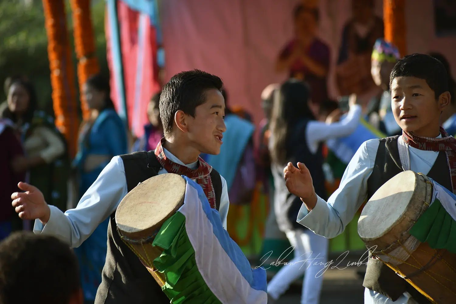
Cultural encounters
Cultural Encounters throughout the journey reveal the remarkable adaptability of Sikkimese communities who have thrived in these challenging mountain environments for centuries.
Interactions with local families provide insights into traditional mountain life—from yak herding techniques to their religious practices that view these peaks as sacred guardians.
The Dzongri trek viewpoints encompass not just spectacular mountain panoramas, but windows into a way of life that has sustained itself through harsh winters, challenging terrain, and profound isolation. Conversations over local meals reveal wisdom accumulated over generations of mountain living, adding cultural depth to your adventure.
Flora and fauna
The Dzongri trail is a moving showcase of Himalayan biodiversity. As you ascend, plant and animal life shift dramatically with elevation—from lush subtropical forests in the lower valleys to wind-battered alpine scrub near the treeline.
In spring, the trail bursts into colour with dozens of rhododendron varieties. Autumn clears the haze, offering crisp mountain views and golden grasslands that catch the afternoon light.
Wildlife sightings are rare but possible. Red Pandas may hide in bamboo patches, Himalayan Tahrs navigate rocky cliffs, and vibrant pheasants flash through forest clearings. Birdlife is constant—adapted to the altitude and active across zones.
This changing ecosystem is the soul of the trek. Dzongri is a journey through living, layered Himalayan environments that few places on Earth can match.
Safety & Important Trekking Tips for Dzongri
Understanding and implementing crucial safety protocols determines the difference between a successful adventure and a potentially dangerous situation on the remote Dzongri Trek.
Communication limitations
Mobile Connectivity becomes extremely limited or nonexistent beyond Yuksom, with no reliable cell phone coverage above 2500 m.
This communication blackout means your trekking group becomes entirely self-reliant for navigation, emergency response, and decision-making.
Plan for complete disconnection from outside communication during the trek’s duration. Inform family and friends of your expected return date with several days’ buffer, as weather delays frequently extend mountain adventures beyond original schedules.
Water safety
Water Sources throughout the route consist primarily of mountain streams and springs that require purification for safe consumption. Carry water purification tablets, portable filters, or UV sterilization devices to ensure safe drinking water from natural sources.
Stream water above treeline generally contains fewer contaminants but still requires treatment to prevent waterborne illness that could compromise your trek.
Boiling water at altitude requires longer time due to reduced atmospheric pressure—water boils at lower temperatures, requiring extended boiling to achieve sterilization.
Your guides manage group water supplies, but personal backup purification capability provides essential redundancy.
Why Local Agents Are Non-negotiable for Dzongri Trek
The Dzongri trek isn’t a weekend hike that you can wing with a backpack and good intentions. This serious high-altitude expedition requires permits, porters, kitchen staff, guides, and complex logistics that only experienced local operators can manage effectively. Attempting this trek without proper local support isn’t just impractical—it’s impossible.
Emergency response capabilities
Yuksom-based agents don’t just shuffle paperwork and hire staff. They’re your emergency response system when someone needs immediate evacuation from remote terrain. These travel agents have spent years building relationships with rescue services, mapping evacuation routes, and identifying emergency shelter points that could mean the difference between a scary story and a tragedy.
The expertise goes deeper than basic logistics. Local guides read weather patterns specific to this region, make critical go/no-go decisions.
Community partnership
Your investment in local guides also sustains the mountain communities that protect these wilderness areas. This economic partnership ensures continued conservation efforts while providing you with operators who have genuine stakes in maintaining both safety standards and environmental integrity.
Based on my experience and observation I recommend two local travel agents in Yuksom.
Black Yak Expeditions – Puspa Lall Gurung
Puspa Lall Gurung brings serious mountaineering credentials to trekking operations. With over a decade of managing expeditions across Sikkim, Ladakh, and technical climbing routes, Black Yak operates with expedition-grade equipment and protocols.
Their high-altitude gear, emergency oxygen systems, and evacuation capabilities reflect the kind of preparation that transforms a trekking company into a legitimate mountain safety operation.
Official Website: www.blackyakexpeditions.com
WhatsApp: 9734190190
Email: puspasikkim@gmail.com
Go Wild Expedition – D.B. Khewa
D.B. Khewa’s strength lies in his extensive regional network and crisis management experience across India, Nepal, and Bhutan. His ability to coordinate rapid response in remote locations, adapt to changing conditions, and maintain communication with village networks makes Go Wild particularly reliable for handling the unexpected challenges that define Himalayan trekking.
Official Website: www.gowildexpedition.com
WhatsApp: +91 9609834977
Group Travel: Your Safety Net in the Himalayas
Trekking in a group is your lifeline when things go sideways in the mountains. When the trail gets tough, group travel becomes your built-in support system. You are not alone when the altitude hits hard, when a knee buckles on a steep descent, or when a sudden snowstorm swallows the path.
Collective decision-making
In a group, decisions are made with more clarity. Someone might notice your breathing is off before you do. Someone might push you to eat when you have lost your appetite. Someone might catch your fall, or run for help when you cannot. These are not dramatic hypotheticals—they happen. And when they do, having people around can be the only reason you make it back.
But it is not just about emergencies. Shared laughter at camp, collective groans on tough climbs, and late-night stories under starlit skies—these moments turn a difficult trek into a deeply bonding experience. Group travel adds meaning. It turns a solo struggle into a shared adventure.
Respect the Mountains, or Do Not Come
Trekking through Sikkim is a sacred journey. These mountains are home to ancient forests, rare wildlife, and spiritual beliefs that run deeper than any trail map. Respect here is a baseline and must not be treated as an option.
Environmental responsibility
That means no littering, no shortcuts through fragile meadows, and absolutely no tossing plastic into streams. What you bring in, you carry out—every wrapper, every bottle cap, every trace. The rule is simple: Leave No Trace. Mountain ecosystems are not built to handle modern waste. One careless act from a trekker can scar a landscape that took thousands of years to form.
Do not pollute water bodies or defecate openly.
Health considerations
I strongly recommend not to smoke and not to drink alcohol on the trek route. It is very, very important for your successful completion of the trek. I don’t want to bore you with scientific fluff, but yes, in high altitudes, drinkers and smokers have some downsides. It is not just for the sake of religious sentiments.
Listen to Your Body—Or the Mountain Will Make You
Out here, your body is your best guide—and your most fragile lifeline. At high altitudes, the cost of ignoring a headache, pushing through nausea, or shrugging off exhaustion is dangerous. You do not “power through” the Himalayas. The mountain does not care how fit or badass you think you are. Out here, ego gets people killed.
Communication is survival
If something feels off, say it—especially to your guide. They are trained to spot warning signs, but only if you are honest about how you are feeling. Even simple things like fatigue or loss of appetite can be early symptoms of altitude sickness.
One person hiding a problem can slow down or endanger the entire group. And remember: asking for help is not a weakness. It is wisdom. Survival in the mountains depends more on humility than heroism.
Emergency preparedness
Dzongri also has minimal mobile network coverage, so you cannot rely on your phone when things go wrong. Make sure you are prepared with basic communication tools like emergency whistles, clear meeting points, and timing protocols—especially in bad weather when visibility drops and voices get lost in the wind.
Almost every incident has some minute errors or negligence. These tips come from years of guiding experience and, unfortunately, from tragedies that could have been avoided. The mountain will always be here. You need to make sure you are too.
Final Words Before You start packing
I still remember the moment when I first stood at Dzongri Top, breathless—not just from the altitude but from the sheer immensity of what lay before me. Unlike today, there were no digital photographs or smartphones. There was just an awareness.
At 4200 m, the world felt both vast and intimate. The silence was absolute, broken only by the wind and my own heartbeat, as Kanchenjunga slowly emerged from darkness—glowing gold under the first rays of the sun.
Preparation is everything
This guide was written to help you get there—not just physically, but prepared, informed, and ready to respect what this trek demands.
If you take only one thing from this guide, let it be this: respect the mountain. Respect the altitude. Respect the environment. Prepare properly. Train well.
Rely on experienced local guides who know these trails, this weather, these rhythms. Acclimatize slowly, pack responsibly, and do not cut corners—not with safety, gear, or time.
Mountain awaits to change your perspective
The Dzongri Trek will show you the beauty that feels otherworldly. But more than that, it will show you what you are made of. It is not just the scenery that stays with you—it is who you become on the trail. It is the friendships forged, the quiet moments when you listen to your body and adjust your pace, and the small victories that build into something unforgettable.
If you are ready to earn those moments—start preparing now. Talk to the right people. Book with someone who cares about safety, not shortcuts. And when the day comes to begin your ascent, step forward with respect in your heart and clarity in your mind.
I promise you that the Dzongri trek will not disappoint you. But it also does not forgive carelessness. Treat this trek with the seriousness it deserves—and it will reward you with memories that stay long after your footprints vanish in the snow.
